How to Snag Free Camping Near Sequoia National Park at the Last Minute
Inside: All the information you need to find and make the most of free dispersed camping near Sequoia National Park in the adjacent National Forest.
Some of the best trips are those taken at the last minute. It’s fun and exhilarating to wake up and decide, “Today, I am going somewhere.”
But where?
That’s the problem.
You have a campervan, RV, or tent camping gear.
You’re set to go.
Or maybe you’re already on the road looking to explore a new destination.
You crave the wilderness, but so, apparently, does everyone else these days. You Google campsites; they’re all full.
You despair.
This is where I recently found myself. Newly retired with a glorious new Glampervan named Eve, all decked out and ready to party. But nowhere to go.
A few weeks ago, I decided to head out from my San Diego base. My heart was set on seeing the giant trees in Sequoia & King’s Canyon National Parks. I’d traveled there years ago, but then with my 6 young children in tow. On that vacation, more time was spent counting heads and making sure I didn’t lose someone than was spent enjoying the forest.
For years I dreamed of returning, this time to gaze up into the towering gentle giants.
I was elated when I found out our National Park Service recently reopened campsite reservations after months of COVID-related shut down. My mood quickly deflated; however, when I could only score two nights. All the other reservable campgrounds were completely booked (more on this later). While I took what I could get, I was disappointed because I wanted to stay longer.
I knew a little about boondocking, or free camping on public lands, but had no experience camping this way. It was time to finally put up or shut up and dive into the phenomenon others raved about.
Heading into the unknown is an uncomfortable place for me. You could say I am a recovering control freak, or, as my children tease me, the ultimate Virgo.
If you’re like me and wonder what dispersed camping is about, then keep reading because I have all the answers you need to find free, gorgeous, private, and safe camping near Sequoia National Park, minutes from the parks’ most popular sites and best hiking trails.
I get it that some of my readers have used dispersed camping sites for ages and are laughing a little at me right now. That’s cool, I am laughing with you. But I am an old lady who lives in a van, venturing out on my own into new, unchartered territory, so be patient. I also know that, like me, some of you are starting out and aren’t sure what “dispersed camping” is all about. This is for you.
Dispersed camping near Sequoia National Park is the bomb. Like the ranger predicted, I’m now addicted.
Getting there
Sequoia and King’s Canyon National Parks are two of the most beautiful and remote jewels in our National Park crown. Located in the Sierra Nevada Mountains southern region, the park is accessible only from the west side of the mountain range. Despite its remote location, it’s easily within a few hours to a day’s drive from San Francisco, Los Angeles, or San Diego.
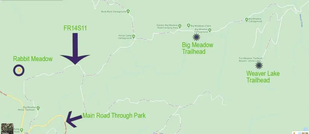
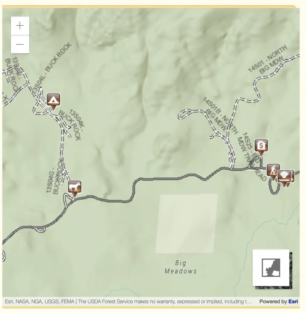
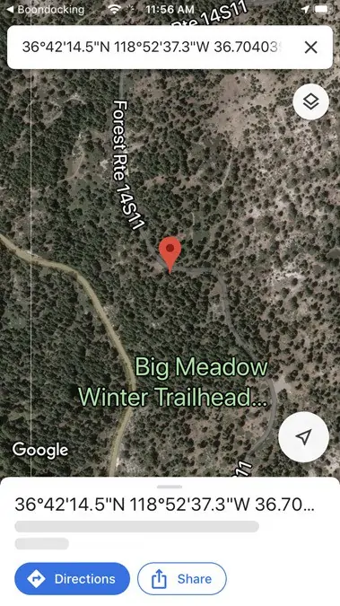
The easiest way to enter the park and get to the dispersed camping sites is to use the north entrance. When you reach the T-intersection you can detour to the left (N) and visit Grant Grove, or turn right (S) and head to the intersection I’ve marked in the following map with a green sun shape. Highlighted in yellow on the map is FR14S11 or Big Meadow Road. This is the main drag of dispersed campsites.
Map of dispersed camping near Sequoia National Park

Driving in the parks
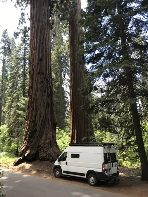
Sequoia & Kings Canyon are mostly between 4000- 7000 feet elevation and that means a lot of twisty mountain driving. I’m telling you this because driving in mountains kind of terrifies me. I don’t like heights, mountain driving, or scary bridges. At all. But I’m working on this and have to say my knuckles barely turned white, even while driving the never-ending miles of switchbacks with precipitous drop-offs I had to traverse as I drove from Big Meadows south to The Giant Forest and ultimately the south park gate.
Every darn time there was a pull-off or shoulder, though, I had to move onto it, and closer to the edge, so I could let vehicles backed up behind me speed by. Which is how I got this beautiful photo. So there!
Do be careful, though, driving down this steep grade. I was very careful not to ride my brakes, used the towing feature on my transmission (lower gears), and, still, my brakes heated up a lot – I could smell them burn. If you don’t like this kind of driving or worry about your brakes, avoid exiting from through the south entrance. Seriously.
Also, note there are vehicle length limits throughout the parks.

Camping inside the National Parks
Unfortunately for last-minute adventurers, official campsites within the National Park boundaries are notoriously hard to book and typically require up to 6 months’ lead time. Spots disappear almost as soon as the reservation system opens them.
2020 presents even more difficulties because most of the park’s campgrounds remain closed and those open are run at 50% capacity to accommodate COVID 19 related restrictions.
And everyone seems to want to camp. Especially in 2020.
2020 – what a year
Only two of the many campgrounds inside Sequoia & Kings Canyon are open this year: Sunset (near Grant Grove in Kings Canyon) and Lodgepole (near the Giant Forest in Sequoia).
On my recent trip, I was lucky to score two consecutive nights (two different campsites) in Sunset Campground in the northern region of King’s Canyon near the General Grant Grove. However, despite the setting’s overall beauty, neither spot had the privacy I wanted AND they cost $22.00/night.
My first night I had an almost flat parking pad, but the rest of the campsite was on quite a hill, and the picnic table was down at the bottom. As shown in the following photos, the view was lovely from the back of my van, but other campsites were pretty close on each side.
Many Sunset campsites have sloped parking pads, so expect some leveling if you have a van, trailer, or RV.
Bonus: Worried about leveling your van? As a bonus for joining my newsletter, you’ll get instant access to watch a video showing how to easily level your van using only a ball and a bottle of soap.
My second night in Sunset I had a place right next to the flushing-all-night toilets and about 20 feet from a group of men who must have missed their favorite TV show as they were intent on gazing in my rear windows. I had to put up my blackout screens to have any privacy, which, unfortunately, also blocked my view of the scenery.
My two nights ran out, and I was ready to leave this campground, but I wasn’t yet ready to leave Sequoia.
Dispersed camping near Sequoia National Park is the way to go
It was time to figure out this dispersed camping business once and for all.
I headed over to the ranger station, where I could tap into their free wifi, and checked iOverlander. Yay! There were quite a few recommended dispersed camping options nearby. But I was still anxious about finding them and apprehensive about what they would be like. I’m a worrier.
Well, thank goodness for road construction (and rangers).
My proverbial guardian angel (in the form of a park ranger) came to me as I waited through a construction delay on The Generals Highway. There’re some serious delays in the summer of 2020, so expect to wait for an hour or more at times to be let through. Have a good audiobook ready.
The ranger was checking on everyone, and when she came to me, I asked her about the dispersed camping. Her face lit up at the question (or at least her eyes lit up because, you know, masks), and she confirmed I was heading in the right direction. She said that the campsites were fantastic and added that dispersed camping would become addictive.
That little interaction gave me a huge confidence boost, and I was soon to discover she couldn’t have been more correct.

The construction delays are real. Here, I waited about an hour for a guide vehicle to take us through the construction.
Camping near Sequoia National Park is better than camping IN the park
Finally, we were let through and I found the fire road cut off (FR14S11 or Big Meadow Road). Shortly, I started to see one fantastic campsite after another, my new problem became, which one to choose!
Below is the interactive Google Map link to Big Meadow Road.
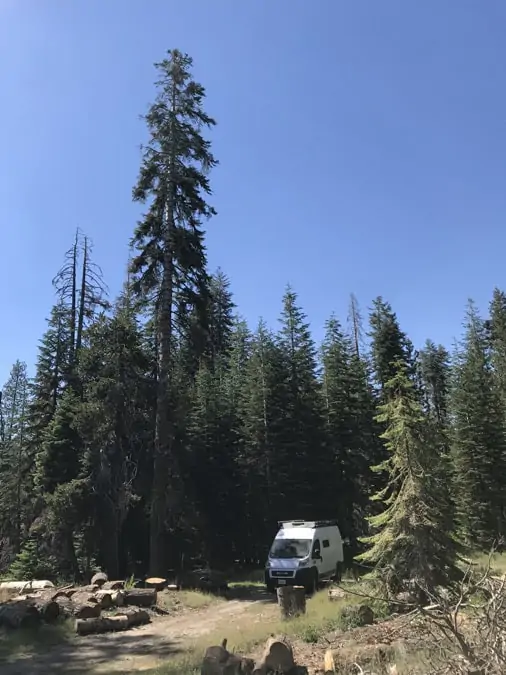
Campsites are spacious, far apart, and absolutely gorgeous. With trees and other vegetation, it was easy to set up in a spot and have no awareness of any other campers nearby. While a majority of the spots were most suitable for small vehicles there were several accommodating to larger RVs and trailers. Along with tent campers, I saw RVs, trailers, and a couple of long schoolies. I only ran into one other van lifer though.
Each site has a fire pit, but nothing else, so make sure you’re self-contained.
If there is a little flag in your fire pit saying no fires – it means NO FIRES. You do NOT want to be responsible for starting the next big forest fire in California. Expect July-October, or when the fall rains start, to be no-fire times. Rangers drove by every day to check and illicit fires garner a $380.00 fine, just so you know.
Propane stoves are allowed, though, even when campfires are disallowed, so you can still cook and make that morning cup of coffee.
For an overview of the National Park camping regulations click here.
I came for the free camping, I stayed because I loved it
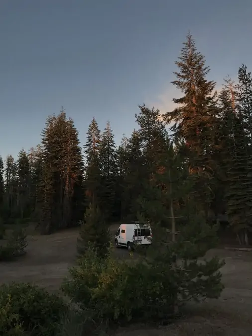
Even though I thought I would only stay a couple more days, I ended up camping for another week, moving to new sites almost every day – just because I could. It was too beautiful to leave.
Below is a detailed map of the dispersed camping area, followed by photos and descriptions of the various sites I used.
By far, the best time to snag a spot is between Monday-Thursday. Friday sites started to fill up and by Saturday afternoon not much was left.
Every site was gorgeous
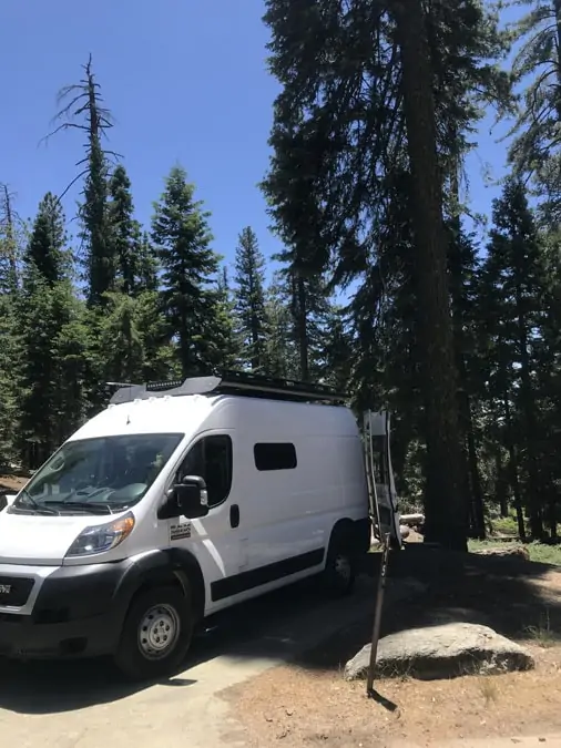
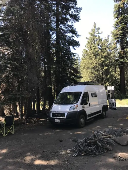
My first night’s site is shown below. I was ALL ALONE (not even a bear to be seen). This spot was more or less under the larger arrow in the above map. It was off a reasonably maintained dirt road that also offered a great hike the next day.
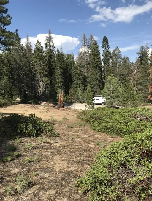
The next few days I moved around to different spots in Rabbit Meadow. This location was at the end of a dirt road off Big Meadows Road and the sites were private, flat and again, gorgeous. They also offered plenty of sunlight to charge my solar system.
Dry Camping
Dispersed camping is dry camping. That means you need to be self-contained. There’s no water, no electricity, and no toilet. While I was there I saw others in everything from large RVs and trailers to tents and everything in between. However, many fewer sites are amenable for large RVs. Most campsites, though, do have flat parking areas suitable for camper vans and class B RVs.
Because I have a van, I take everything with me when I head out to find hiking or a wifi spot (more on that later). This is problematic as I’m never sure I’ll have my campsite when I return.
I’ve considered leaving a chair out, and that probably works to identify the site as occupied, but I worry about someone just taking the chair and my spot.
Yes, I can always find something to worry about. I am working on that.
For the future, I may get a little 1-person cheapo tent to set up on sites I want to claim for more than one night. On this trip, I just stayed put over the weekend and found plenty of hiking straight from my campsite. On weekdays it didn’t matter – there were loads of sites free.
Buck Rock and Horse Corrals
As you drive further along Big Meadows Road, you’ll find the Horse Corrals, a first-come, first-served camping area for people with…surprise! Horses. Just past the corrals, branching to the left is a dirt road turnoff to Buck Rock Campground, another first-come/first-served campground, this one with pit toilets. Just click on the map below for more information.
Further down Big Meadow Road are the two official National Forest Campgrounds (reservations needed, pay-for slots, and pretty crowded). Trailheads for some of the best hikes (including the Weaver Lake hike I describe shortly) are down here to (I say down because it is literally down in a little valley).
How to deal with your trash
Near Big Meadow Road’s junction with The Generals Highway is a sizeable pull-off picnic area with portapotties and bear safe garbage containers. Either use these containers or take trash with you. Pack it in, pack it out.
At your campsite, you’ll need a portable toilet, I have a Camco 2.6 gallon cassette toilet that is small and works well. If you don’t bring a portable loo, you will need to bury waste in a “cat-hole” at least 6 inches deep. So bring a shovel.
If you use a portable loo, you can keep it cleaner by collecting solid waste in compostable bags (don’t confuse with biodegradable bags – they’re different) and these can also be buried at least 6 inches deep.
Shovels come in handy
I have a shovel and it sure came in handy when I got stuck exploring a campsite I thought would have a fantastic sunset view. The slope was a bit of a stretch for my van, and the soil was very loose and dry. My tire dug in deep, and I had to dig out a bit. It reminding me of my formative years in the Midwest, digging out of snow.
Don’t leave home without a shovel!
With the sole exception of your buried poo, don’t leave anything behind. I found a disconcerting amount of garbage at some sites. Don’t be that camper. Please.
Keeping clean when dry camping
To my surprise, keeping clean without access to a full bathroom is a lot easier than I anticipated. I use baby wipes for a quick wipe down after hiking or before bed. I can “bucket wash” my hair with my outdoor shower, and use dry shampoo to extend the time between wet washes.
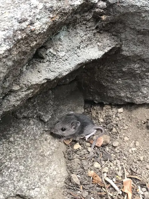
Bears, oh my!
You share this forest with bears. I didn’t see any but am assured they are plentiful. Keep your food, toothpaste, toothbrushes, plus anything with an attractive smell inside your vehicle and out of sight.
Summer weather is pretty close to perfect in Sequoia National Forest, but the elevation is 4000-7000 feet, so it gets chilly at night. For detailed information on the weather, click here.
Insects
Insects were not an issue during my stay. A collection of beehives, though, is set up near Rabbit Meadow, and one day the bees seemed to find something in my van attractive – I had to unroll my screens for a couple of days. A few flies bothered me on hikes, but very minimally (and I’m an insect magnet). I never found it necessary to use insect repellant.
What about cell coverage and wifi?
Don’t expect coverage anywhere in the National Parks or surrounding National Forest. Supposedly, Verizon has reasonable coverage along Big Meadow Road, but I ran into one person who was not finding this to be true. I have ATT and had one momentary blip of coverage when my phone blasted in about 20 texts, and then the signal disappeared.
If you have to connect, head over to one of the parks’ ranger stations for your best shot at wifi. You’ll see a mass of people set up all around furiously tapping at their devices.
I also found good free wifi at Stony Creek Village (which is not a village, but a gas station and modestly stocked convenience store). Stony Creek is about 20 minutes or less from the dispersed camping area (or over an hour on weekdays when the road construction is happening). From here, I was able to Zoom into one of my bookclubs with no connectivity issues.
Don’t do what I did (or what I forgot to do)
About that wifi…when you do have a signal make sure you download everything you might possibly want or need. Most important, download your hiking maps. AllTrails is, by far, the best hiking app out there, and I strongly recommend paying for the professional version for one important reason – you can download maps and access them even when there is no signal.
This can come in very handy, especially if you get lost – not that that happened to me (she says chagrined). Read on and I’ll tell you about it.
Don’t leave home without…
Also, I never leave home without my paper maps. Yes, I get it that this labels me as a troglodyte, but when camping near Sequoia National Park, or in other remote areas – like much of California and other western states – don’t expect good cell signals to power your navigation system.
I use my trusty Rand McNally Road Atlas & National Park Guide, and my DeLorme California Atlas all the time.
Another reason to have paper maps handy is that GPS won’t easily give you off the beaten track routes from A to B and when I am out in my van I like to avoid interstates and major highways. It’s about the journey, not getting there by the fastest route. The California Atlas (thanks ME and B for recommending it!) has every little road in California – especially those with dispersed camping nearby.
Now you’ve arrived, what is there to do?
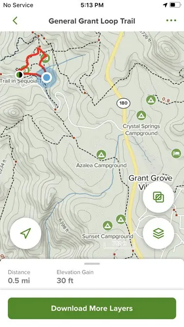
My first afternoon, while still in Sunset Campgrounds, I hiked over to one of the most popular trails, The General Grant Loop Trail. It was an easy hike straight from Sunset and went through Azalea Campgrounds. Azalea was closed this summer, but looked very nice.
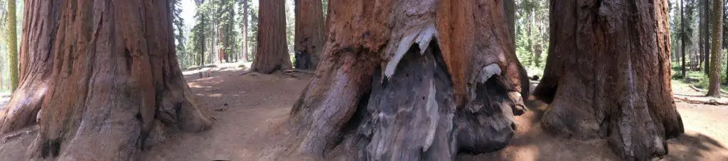
General Grant Tree is the focal point and the largest tree in the grove, but there looks to be many close contenders.
Below, I show screenshots of the AllTrails maps for some of my hikes. As I said above, I strongly recommend paying for the AllTrails upgrade as it allows you to us track yourself on previously downloaded maps, even with no cell signal.
Make sure to download all the maps you may want ahead of time, though, because you won’t be able to do so when you are at your campsite. Remember – no cell signals in the parks.
General Grant Loop Trail

It ‘s easy to find a new hike every day when you’re camping near Sequoia National Park. Some days I picked an easy flat route, and a couple of days, I went out for several hours and 5-7 miles. I’m in good physical condition for my age (almost 60 years), and the 6+ mile hikes, with elevations in the 7000-foot range, were a good test of my endurance. A couple of the longer hikes stretched my endurance and my knees. Oh to be young again.
Park Ridge Trail
Park Ridge Trail starts at Panoramic Point, accessed via a narrow twisty road intersecting with Generals Highway just across from the entrance to General Grant Grove. Only van-sized and smaller vehicles are allowed on this road (one good reason to have a camper van) and many segments are single lane. The view and the hike are worth the precarious drive.
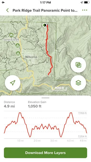
The AllTrails map download shows the route, elevation and where you are on the trail.

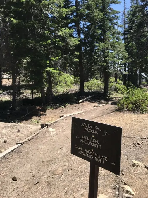
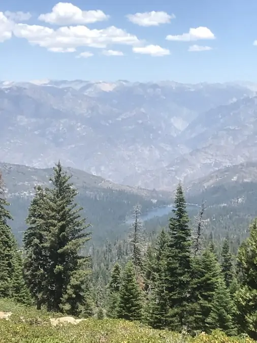
The Park Ridge Trail is an out-and-back hike to a fire station, with a 1050 foot elevation gain and AMAZING views. In fact, the views are so amazing it is easy to get distracted by them and go off track, especially about midway where three trails intersect. See the blue dot on the map to the right? That’s me about when I started thinking, “Hmmm, I don’t remember this from the hike out…” Yay AllTrails.
I actually took the photo on the left as I hiked OUT to the fire station, telling myself to be careful and stay on the correct trail. Oops. So I hiked an extra half mile or so. At the time it felt like an extra 10 miles, but the view WAS amazing.

Hume Lake
Hume Lake is another place to find camping near Sequoia National Park, and you can also find gas and shops in the area. I didn’t manage to get down there, but you can research camping options (paid) here. Hume Lake is on my list to check out on my next visit.
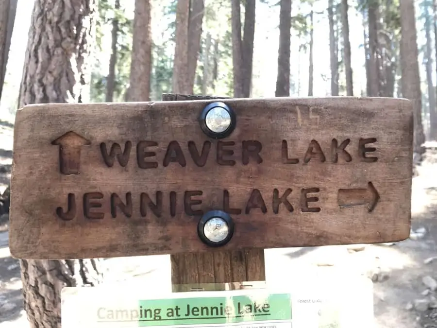
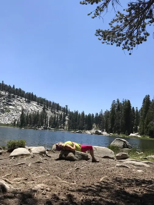
Weaver Lake
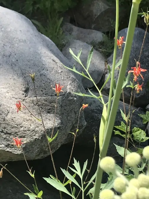
My last big hike took me to a pristine mountain lake. On this and my other hikes, I saw barely another soul. It was me, the mountains and wildflowers.
Mind the signs

The Giant Forest
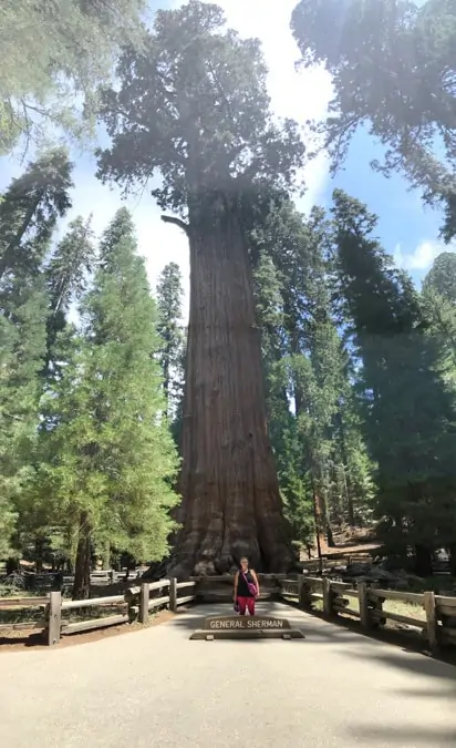
On my last day, driving along Generals Highway to the southern park gate I stopped to see General Sherman Tree. It was a shock to my system to be back in what felt like an overpopulated area.
Back to masks and social distancing (it is still 2020).
But the tree is pretty darn impressive. I love these gentle giants.
The Hike I’ll Never Go On
One last drive took me along the southern edge of The Giant Forest. This is another road accessible only to small vehicles and one feels dwarfed by the towering sequoias surrounding you.
This is the road that takes you to one of the more aspirational hikes in the park – and one I will NEVER go on. I am working on my fear of heights, but I see no reason to overreach. I’ll let others take this hike. Watch the video below (that I did not make) if you want to vicariously hike to the sky.
Home again
I am home now from my magical trip to Sequoia. Back to my bricks & mortar home, but already feeling antsy to head out again.
Next time I’m not even looking for a reservation, though. I’ll check my apps and find a free spot to land in.
The ranger was right – once you discover dispersed camping near Sequoia National Park, you’re addicted.
If you’re new here – welcome! If you’re ready to start dreaming about or planning your epic adventures, be sure to subscribe to SSSNOOlife blog updates. We’ll plan and explore together.
SSSNOO, I really enjoyed your Kings Canyon and Sequoia adventures. We loved both places. You did not exaggerate their awesome beauty. We didn’t get to stay long enough, so thanks for the directions on how to follow in your footsteps.
You are so welcome Beth! Keep me posted on your adventures, especially places you think I should visit and write about. I am so glad you have joined SSSNOOlife.
Thank you so much! This was so so so helpful as we try and trek out doing this same thing this Labor Day weekend. Hopefully some spots *fingers crossed*
Good luck! Let me know how you fair.
You are leading people to these sites that trash them and have no etiquette for the outdoors. They don’t care because they didn’t work to find them and have no appreciation. Stop geotagging and spoiling beautiful places please.
I understand your concern for these sites and the principle of LNT. I am not, however, convinced that people who “work” more to find the spots appreciate them more. My audience is largely older solo women campers, many of whom are intimidated by dispersed camping, but are also pretty darn good at (and experienced at) cleaning up after themselves and others. It would be interesting to have some data about who is bringing more trash and destruction to the dispersed spots lately. I don’t think it is my small audience. My hypothesis is that it is the younger demographic who head out to a party or totally unprepared with no portable toilet or shovel. The sites I write about are all “hidden in plain sight” and apps like iOverlander (how I find them) have a much broader reach than I do. That said, I hear you that LNT is critical. There are many many reports of poor etiquette this year, I cleaned up trash and shit (literally) at the dispersed sites I’ve been to, and I want these places open and preserved. But I also don’t believe they should be secret or hidden. I will continue to advocate for campsite etiquette and LNT. I think we both agree that this is important.
National parks are for everyone to enjoy and gatekeeping is lame. She mentions packing out, which is plenty of due diligence to remind readers.
Are any of the dispersed sites on or lakes or creeks? My wife and I like to fish along with our boondocking ?.
Any suggestions would be appreciated!
Hi, thanks for your question Kurt. I didn’t see any sites in the area I camped that were near fishing. I hiked to some lakes where you could probably fish, but I honestly don’t know the rules for where you can fish. sorry I can’t help more.
Hi, Thanks for the tip! Our class B doesn’t have 4WD. How difficult was fire road in your van?
I also don’t have 4WD, but Promasters are front-wheel drive. I had no issue s– the roads were good. There was one campsite I hiked by and REALLY wanted to camp in, but the issue was an overhanging tree. I had no issues getting stuck except once when I tried to park in a specific camp spot and knew I was pushing it. In the summer the soil was very dry and powdery and I sunk like in sand. I got out pretty easy though. This was off the road. The roads are pretty good. Good luck!
Sandra, this was the most helpful post we have found on our whole road trip out west!! Because of your recommendation we found an amazing camping spot on the Big Meadows road and stayed there three nights. It was beautiful and peaceful just like you said. Three cheers to you and your travels ??
This makes me so happy! Enjoy your travels too!
Hi!!! I’m looking into doing the same dispersed camping . Do you have the exact coordinates of your free camping spots?
Sorry, I do not – only the maps that I provide in the article. There are many spots in this area of the park so I suggest you pick the one you like the best. There is a lot of snow this year so I’d check and make sure the roads and park are open for camping. Have fun!